.png)

SECO Weather 7 Day Forecast Jan 8th-14th 2026
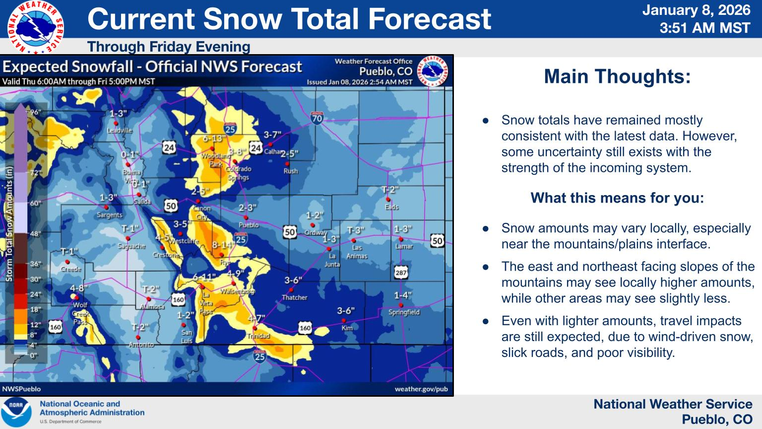
Description: Provided by Pueblo NWS
Today
A 40 percent chance of showers, mainly after 3pm. Mostly cloudy, with a high near 46. North northwest wind 5 to 10 mph becoming east in the afternoon. New precipitation amounts of less than a tenth of an inch possible.
Tonight
Rain and snow showers, becoming all snow after 11pm. Low around 26. East northeast wind 5 to 10 mph. Chance of precipitation is 80%. New snow accumulation of 1 to 2 inches possible.
Friday
Snow showers likely, mainly before 8am. Cloudy, then gradually becoming mostly sunny, with a high near 35. North wind 10 to 15 mph. Chance of precipitation is 60%. New snow accumulation of less than one inch possible.
Friday Night
Mostly clear, with a low around 10. West wind around 5 mph.
Saturday
Sunny, with a high near 42. West northwest wind 5 to 10 mph.
Saturday Night
Mostly clear, with a low around 17. West northwest wind around 5 mph.
Sunday
Sunny, with a high near 46. West wind around 5 mph becoming south in the afternoon.
Sunday Night
Mostly clear, with a low around 21. West northwest wind around 5 mph.
Monday
Sunny, with a high near 53. West wind around 5 mph.
Monday Night
Partly cloudy, with a low around 25. West northwest wind around 5 mph.
Tuesday
Mostly sunny, with a high near 55. North northwest wind around 5 mph.
Tuesday Night
Partly cloudy, with a low around 26. Northwest wind around 5 mph.
Wednesday
Mostly sunny, with a high near 52. West northwest wind 5 to 10 mph becoming north in the morning.

